SENIOR HONORS INDEPENDENT STUDY
APPLICATION (Revised December 2023)
PLEASE NOTE:
- The SHIS application and addenda (if applicable) are due to Mr. Ramos, either via email or uploaded to the shared Google folder, ==by noon (12 pm) on Monday, April 29, 2024.==
- Incomplete or late applications will not be forwarded to the SHIS Application Review Committee for review.
- If your SHIS Application includes the use of interview questions, surveys, questionnaires or human participants for research or experiments through which you intend to collect data:
- You must have completed AP Statistics, or enroll in AP Statistics in your senior year, or complete an approved Statistics course over the summer in order to be able to analyze the data that you plan to collect for your experiment.
- You must complete the two addenda below, in addition to this SHIS application, and submit all of these documents together by the application deadline above. These forms are available on the “SHP Senior Honors Independent Study Program” webpage in the Student Portal of our SHS website:
- “Addendum A: Research Experiment Plan”
- “Addendum B: Human Informed Consent Form”
- For Capstone Project Credit - In order for your Independent Study to qualify for Capstone credit, your project must investigate a specific justice issue and work to produce a tangible good for the community. You will need to submit additional work to Service Learning and through x2Vol.com, including your Capstone Project Proposal Form, academic research, 25 hours of proximity to the issue, and 2 – 3 pages of reflection & analysis (you can use your final project write-up).
Name of Student Applicant: ==Roshan Taneja==
I. COURSE DESCRIPTION
Name of project: ==Object Detection on Public Satellite Data For Scaled Placement of Water Harvesting Units in in East Africa==
Department sponsoring project: ==Computer Science==
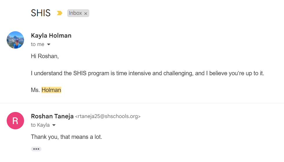
Name of on-campus mentor: ==Ms. Kayla Holman==
Professional Experts
Names and professional credentials of three (3) off-campus experts, including their title and occupations and an email address where they can be reached:
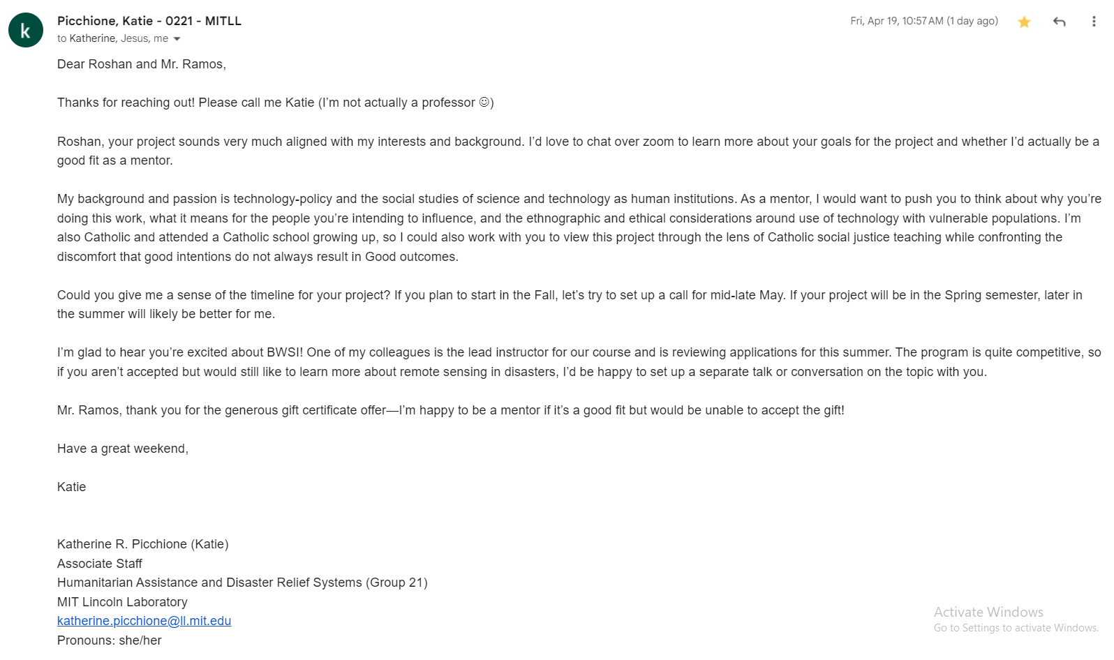
Katie Picchione
Associate Staff, Humanitarian Assistance and Disaster Relief Systems, MIT Lincoln Laboratory
katherine.picchione@ll.mit.edu
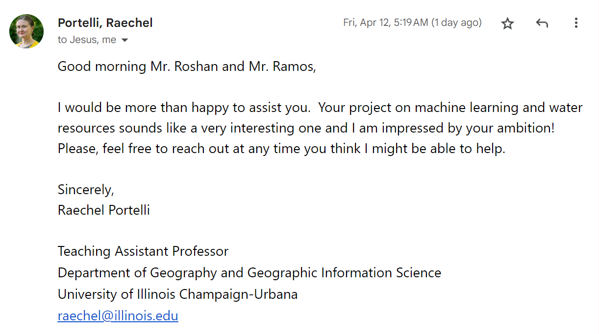
Raechel Portelli
Teaching Assistant Professor, Dept. of Geography and Geographic Information Science, UIUC
raechel@illinois.edu
Description of Experience of Independent Work
Please describe in approximately 150 words an experience in which you have demonstrated your ability to work independently. Keep in mind any opportunity, group work, project, idea, passion or interest in which you have taken the initiative, followed through with completion, or pursued. Be as specific as possible.
There are two things I love in this world: Computer Science and Retro Video Games. One of my favorite games is space invaders, so I decided to build a Reinforcement Learning agent to beat the game (because I never could). I utilized a Q-Network and a Target Network to calculate Q-values, optimizing the agent's decision-making process. The model learns as if it has played every possible move in the game prior and generates a policy based on those "experiences" to play better next round. The model simply learns from its mistakes, and maximizes its cumulative reward at the end. This approach involved storing experiences as tuples (state, action, reward, next state), refining the model through iterations, and adjusting weights. Through this endeavor, not only did I deepen my understanding of reinforcement learning principles and algorithms, but I also honed my skills in problem-solving and algorithmic thinking. The project's results demonstrated significant improvement in the agent's game performance, showcasing my ability to independently apply complex machine learning algorithms and neural networks in developing practical solutions and pursuing projects to completion.
Guiding/Essential Questions
List the Guiding/Essential Questions you are posing in your study that will guide your overall study and research.
- ==TOP LEVEL QUESTION:== How do I use publicly available satellite Information to identify and accurately assess population densities?
- How does object detection work?
- How can I use computer vision to recognize objects?
- How do satellites process Image Data?
- Can I train an object detection model on raw satellite data?
- Can I run an object detection model on raw satellite data?
- What is the best scanning algorithm for a problem of this scale?
- How do you assess the best locations to place water harvesting units using population density?
Description of Content Areas
Describe in approximately 200 words what you propose to study. Be as specific and as complete as possible.
My SHIS will focus on the integration of Machine Learning and Remote Sensing into Environmental Sustainability. I want to investigate how these two fields of study can be used in parallel to accelerate humanitarian initiatives. So far, there hasn't been much involvement of computer science in the geographic imaging field, however,
Description of your motivation for pursuing this independent study
Describe in 150 – 200 words what has motivated you to undertake this work, what specific approach(es) you plan to take in this study, and how this study fits into your overall academic values.
The Maasai women and children in the Monduli District of Tanzania walk over nine hours every day to collect water. Over the last four years, I have been working with this community, fundraising, and deploying water harvesting solutions in the area. So far, we have installed four units across the district. My field research confirms that water harvesting units have doubled educational and economic activity for over 4500 community members within a 10-mile radius, as access to water frees Maasai women to pursue economic endeavors and enables children to attend school. There are over 30,000 Maasai spread over 300 sq. miles. To scale this project, I want to find the most densely populated areas where I can place water units. There are no maps of where people live, no roads, just wilderness. So, I turned to satellite imagery. I want to train a object detection model to recognize housing units from public satellite data and create a density heatmap, pinpointing locations for future harvesting units. The model could pinpoint the 15 best locations to place water harvesting units to have the most impact.
List of Objectives and Learning Goals
List, in bullet points, the major learning objectives, outcomes or goals that you plan to accomplish by the end of your independent study. Begin your list of bullet points with the phrase, “By the end of my independent study, I intend to:…”
==By the end of my independent study I intend for...==
List and Description of Key Assignments and Major Assessments
List and write a brief description of EACH key assignment and major assessment, with approximate number of pages (e.g., pp. 5 – 7) that will form the basis for assessment. PLEASE NOTE: 1. For SHIS Applications through the English, Religious Studies, Fine Arts or World Languages department, your Paper #1 should be an “annotated bibliography” paper in which you will describe each source that you use, its theoretical perspective and contribution to the field, and explain its use for your project. 1. ALSO: If your research or experiments include interview questions, surveys, questionnaires or human participants, you must complete the “Research Experiment Plan” and the “Human Informed Consent Form” documents in addition to this application. If your application is approved, you must have completed AP Statistics, or enroll in AP Statistics in your senior year, or complete an approved Statistics course over the summer in order to be able to analyze the data that you plan to collect.
Formal Bibliography of Proposed Resources
List a minimum of ten (10) non-internet sources, including title, author and all publication information. If you choose to include “internet” sources, they need to be credible and not just random websites, (i.e., from online websites such as academic and professional journals or databases, etc.)
Please use MLA or Chicago Style format, depending on your sponsoring department’s policy for works cited. * e.g., MLA STYLE:
Author’s Last name, First name. “Title of the Article or Individual Page.” Title of the Website, Name of
    the Publisher, Date of Publication in Day Month Year format, URL.
- https://gis.stackexchange.com/questions/197607/pattern-search-in-satellite-imagery
- https://www.diva-portal.org/smash/get/diva2:1119048/FULLTEXT01.pdf
- https://ieeexplore.ieee.org/document/8862452
- https://gisgeography.com/image-classification-techniques-remote-sensing/#:~:text=Unsupervised%20and%20supervised%20image%20classification,useful%20for%20high%2Dresolution%20data
- https://www.ncbi.nlm.nih.gov/pmc/articles/PMC10347255/
- https://www.artefact.com/blog/applying-machine-learning-algorithms-to-satellite-imagery-for-agriculture-applications/
- https://www.researchgate.net/figure/Satellite-image-classification-techniques_fig2_333538172
- https://www.nature.com/articles/s41467-021-24638-z
- https://www.iceye.com/satellite-data
- https://developers.google.com/s/results/earth-engine/datasets?q=tanzania&text=tanzania
- https://github.com/satellite-image-deep-learning/techniques
- https://www.spiceworks.com/tech/artificial-intelligence/articles/what-is-spatial-analysis/
- https://www.explorium.ai/blog/location-data/satellite-data/
II. DETAILED 16 – WEEK SYLLABUS
To include a weekly schedule of: ● Major readings ● Major assignments/assessments and their due dates ● Journal or “process work, if required ● Any field excursions / projected meetings with off-campus mentors (as appropriate) ● Weekly meetings with on-campus mentors
Please note: Syllabus may also include work done over the summer before senior year. If so, please provide a detailed, day-to-day, week-by-week syllabus of your summer work.
| Week | Layout |
|---|---|
| Summer | Take the MIT Beaverworks Course in "Remote Sensing in Disaster Management". (Have already applied, will notify jramos and kholman if accepted) |
| 1 | Introduction to Remote Sensing Assignment: Read 3 papers on remote sensing systems and use cases [i.e., water resource detection, living location etc] |
| 2 | Introduction to Geographical Informational Systems (What is GIS, Where do you source satellite imagery data from, why we use GIS) Assignment: Identify and Record 2 GIS systems and how they are accessed. Public and private data sources used by Universities |
| 3 | Introduction to Computer Vision. Assignment: Small Project on public image library. Create a Classifier. |
| 4 | Introduction to Object Detection Assignment: Use Object Detection to tell where a classified object is in an image. |
| 5 | Dataset Collection and Storage for images (Learn how machine learning companies create training data) Assignment: Create your own dataset of images and train a small an object detection model; Validate and learn how it works |
| 6 | Dataset Sanitization techniques used in Machine learning (Why Data is tricky to use, why we need to sanitize, techniques used) Assignment: Use your hand-created dataset from last week and sanitize the data, see if that makes the model more accurate. |
| 7 | Public Data Collection of Satellite Imagery for Tanzania/Monduli District Assignment: Identify Publicly Available GIS Systems and access their data. |
| 8 | Dataset Collection of Housing Units [and non Housing units] to be used to train the algorithms Assignment: Use the publicly available data to generate a dataset of Housing Units (may take more than one week). 10000 Units of data to be created for training |
| 9 | Training the Model on the 10K unit data set Assignment Sanitize data and train model; continue data cleaning and rerun the algo |
| 10 | Scanning Algorithm (learn how machine learning algorithms are deployed on real world data) Assignment: Find and Access a GIS System that enables live scanning. |
| 11 | Deploy Model in a public cloud system [like AWS] Assignment: Deploy Model on Public Data and see accuracy levels |
| 12 | Final Algorithm, validation and testing. Assignment Refine the accuracy of the object model detection Increase trained datasets |
| 13 | Create the visualization of the housing locations Assignment Create draft visualization and clustering of living locations Continue refining the accuracy of the model up to >85% |
| 14 | Build a draft proposal for locations of the water harvesting units Assignment Build an initial proposal on location of water harvesting units layered on top of the visualization Summarize the research and project into a formal paper [Draft 1] Prepare the final dataset |
| 15 | Complete the draft paper and draft of the presentation Assignment Validate learnings with external and internal advisors Prepare Draft 2 of the paper Prepare Draft 1 of the presentation |
| 16 | Assignment Complete Presentation Practice Oral Presentation Complete Final Paper |
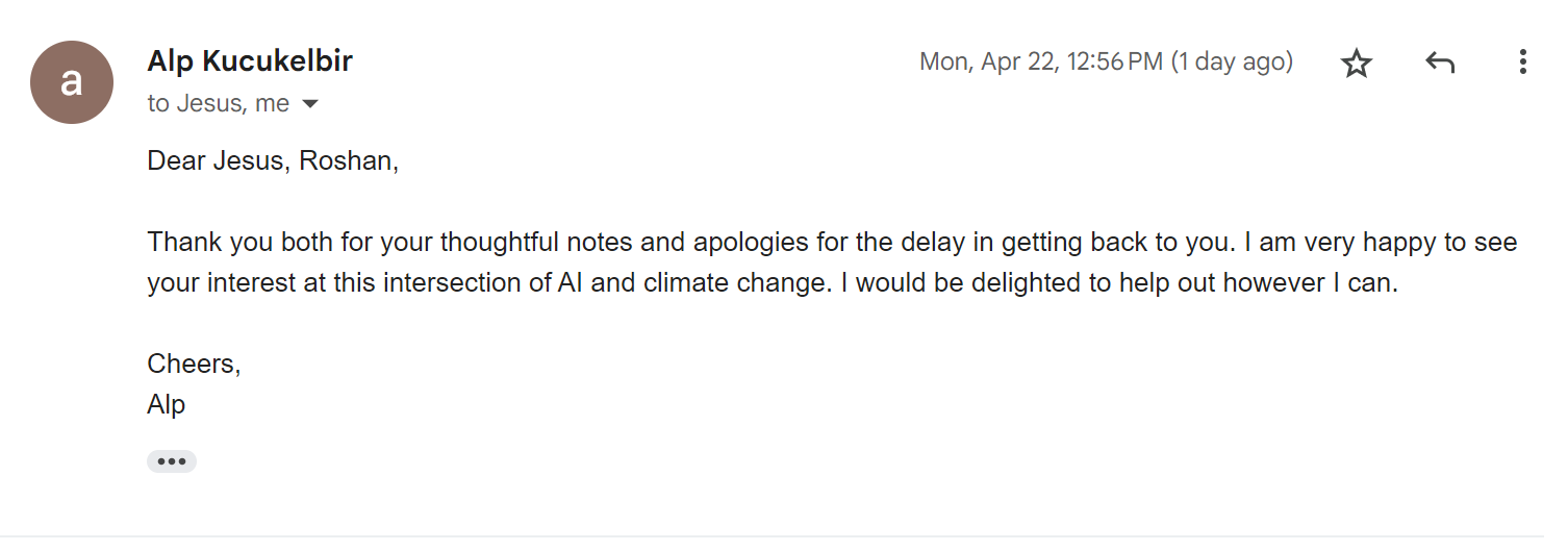
III. EMAIL OF AGREEMENT FROM THREE OFF-CAMPUS EXPERTS
IV. EMAIL OF BRIEF RECOMMENDATION FROM A SACRED HEART TEACHER
verifying your ability to undertake and follow through on independent work of a sustained nature.
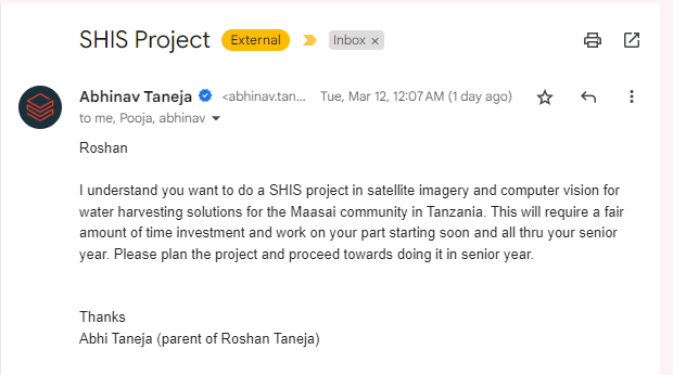
V. EMAIL FROM PARENT/GUARDIAN
indicating an understanding of the SHIS program, its rigor and assessment guidelines, and support of the student’s application
VI. BRIEF STATEMENT OF PREFERENCE FOR FALL OR SPRING SEMESTER
to include any compelling reason(s) for this preference. Please note that this preference is not guaranteed but rather considered in the process of evaluating and balancing independent study projects per semester.
I would prefer to do the project during the fall semester for a few reasons.
As detailed above, this independent study is part of a much larger project, hence, time is of the essence. Just a week ago, the largest few water dam in the Monduli district broke through, leaving over 70,000 Maasai without water in the upcoming drought season this winter. Time is of the essence.
During the fall semester, my only commitments are my grades and college applications. However, robotics building and competitions take a lot of my time during the first 2 months of spring semester, with all of my time after school and weekends being devoted to placement in qualifiers. Later in my spring semester, I will be busy with AP exam preparation and will also have less time to focus on my independent study.
Related
- 1_Genesis — the GIS/CV research the independent study grew from
- Water_Vision_Presentation — project overview presentation